What is Georeferencing and How Can Businesses Use It?

Georeferencing refers to the process of assigning spatial or geographical references to data. By linking information to specific geographic coordinates or locations, georeferencing enables users to place the data accurately on a map. It provides the crucial geographic framework needed to layer, analyze, and visually represent different types of location-based data.
General Applications for Georeferencing
Georeferencing has a wide range of applications across many industries and use cases. It is commonly used in mapping, navigation systems, urban planning, logistics, market analysis, and environmental modeling. Georeferencing provides the geographic framework needed to link, visualize, and analyze data based on location.
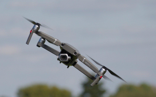
With recent advances in drone technology, georeferencing is also being leveraged for aerial surveying and photogrammetry, as well as for military drones used in active combat zones in the Middle East and beyond.
Drones equipped with cameras and sensors can efficiently capture detailed geospatial and intelligence data over large areas. This data can then be georeferenced to create accurate 2D and 3D maps for applications like construction, precision agriculture, and disaster/military response.
For businesses, georeferencing unlocks a wealth of potential uses and applications. Here are some of the key ways organizations can leverage georeferencing to enhance operations, strategy, and overall business value:
Targeted Marketing
One of the most powerful uses of georeferencing for business is in targeted marketing. By geocoding customer data such as addresses, demographics, and buying preferences, businesses can pinpoint target markets based on location. Stores can send promotions to customers near specific branches. Real estate agencies can market to homebuyers in up-and-coming neighborhoods. The possibilities are vast.
Site Selection
Georeferencing aids businesses in selecting optimal locations for new stores, warehouses, and other facilities. By overlaying demographic, traffic, and competitor data on digital maps, companies can identify areas with the right mix of customers, accessibility, and growth potential. This allows for smarter, data-driven site selection.
Supply Chain Optimization
By mapping supplier and factory locations along with logistics networks, businesses can optimize complex global supply chains through georeferencing. It allows analysis of how geography impacts the flow of goods, enabling companies to reduce costs and lead times. Georeferencing unlocks supply chain insights not apparent from tabular data alone.
Market Analysis
Layering sales data, customer segments and competitor locations using georeferencing provides businesses with powerful market analysis. Companies can identify untapped local markets, areas at risk from new competitors, and locations best suited for expansion. Georeferencing converts spatial data into strategic insights.
Customer Profiling
Detailed customer profiles based on geographic data help businesses better understand demand. Linking customer addresses with demographics like income level and family size allows more accurate customer segmentation. Businesses can tailor products and messaging for different locations.
In short, georeferencing adds a vital geographic context to business data. The process enables companies to visualize data through digital maps and gain critical location-based insights. By leveraging georeferencing, organizations can optimize strategy, expand into new markets, streamline logistics, and deliver more value to customers. The spatial capabilities added by georeferencing generate business benefits not possible with data alone.


